Trail Walking La Petite-Pierre - Chemin vers Graufthal - Photo

Chemin vers Graufthal

 cathel11
cathel11

User

© OpenStreetMap contributors
Length
Length
16.6 km
Max alt
Max alt
383 m
Uphill gradient
Uphill gradient
601 m
Km-Effort
Km-Effort  
25 km
Min alt
Min alt
200 m
Downhill gradient
Downhill gradient
599 m
Boucle
Boucle
Yes
Creation date :
2019-03-03 11:37:43.013
Updated on :
2019-03-03 11:37:43.053

(0 Reviews)

Walking
Walking
5h13
Difficulty : Difficult

Scan this QR Code to open this trail in the SityTrail application

FREE GPS app for hiking

Logo SityTrail SityTrail

IGN / Geographical institutes

Download SityTrail from the App Store Download SityTrail from Google Play

Logo SityTrail SityTrail World

The world is yours!

Download SityTrail from the App Store Download SityTrail from Google Play Download SityTrail on Huawei AppGallery

About

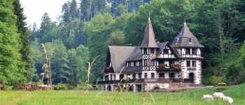
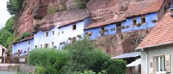
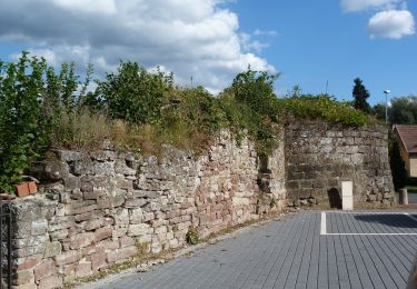
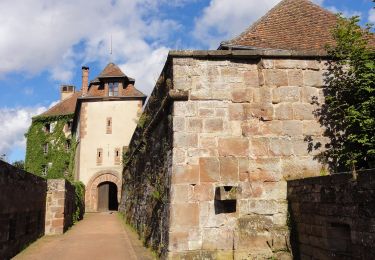
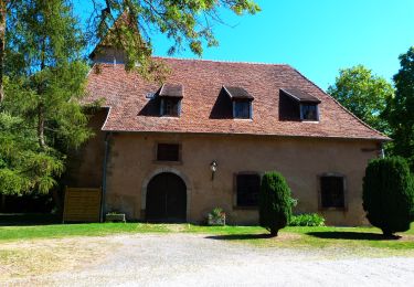
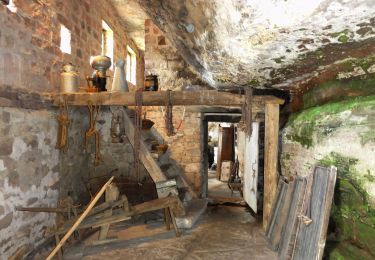
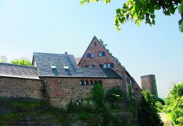
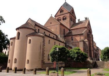
Trail Walking of 16.6 km to be discovered at Grand Est, Bas-Rhin, La Petite-Pierre. This trail is proposed by cathel11.

Description

Le départ de cette boucle s'effectue depuis le parking situé devant l'Office du tourisme à La Petite Pierre et nous mènera jusqu'à Graufthal pour une visite des maisons troglodytes par le GR53. Le retour s'effectuera par le rocher des païens et  le rocher blanc

Elevation profile

Photos

Points of interest

Point of interest La Petite-Pierre - Parking office du tourisme - Photo
cathel11
LA PETITE-PIERRE 
Point of interest La Petite-Pierre - Rocher du corbeau - Photo
cathel11
LA PETITE-PIERRE 
Point of interest Eschbourg - Moulin de la Petite Pierre - Photo
cathel11
Point of interest La Petite-Pierre - Etang de Dimsthal - Photo
cathel11
LA PETITE-PIERRE 
Point of interest La Petite-Pierre - Rocher blanc - Photo
cathel11
LA PETITE-PIERRE 

Positioning

Country:
France
Region :
Grand Est
Department/Province :
Bas-Rhin
Municipality :
La Petite-Pierre
Location:
Unknown
Start:(UTM)
376745 ; 5412914 (32U) N.

Trails nearby

Trail On foot La Petite-Pierre - Triangle vert - Photo
On foot
PRO

On foot

Easy
La Petite-Pierre, Grand Est, Bas-Rhin, France
15.1 km | 19.2 km-effort
4h 22min
No
Trail On foot La Petite-Pierre - Anneau bleu - Photo
On foot
PRO

On foot

Easy
La Petite-Pierre, Grand Est, Bas-Rhin, France
4.7 km | 6.8 km-effort
1h 33min
Yes
Trail On foot Eschbourg - Triangle rouge - Photo
On foot
PRO

On foot

Easy
Eschbourg, Grand Est, Bas-Rhin, France
6.8 km | 9.7 km-effort
2h 12min
No
Trail On foot Eschbourg - Chemin des Fontaines - Photo
On foot
PRO

On foot

Easy
Eschbourg, Grand Est, Bas-Rhin, France
6.6 km | 9.1 km-effort
2h 3min
No
Trail On foot Dossenheim-sur-Zinsel - Croix rouge - Photo
On foot
PRO

On foot

Easy
Dossenheim-sur-Zinsel, Grand Est, Bas-Rhin, France
13.2 km | 17.1 km-effort
3h 53min
No
Trail On foot La Petite-Pierre - Triangle rouge - Photo
On foot
PRO

On foot

Easy
La Petite-Pierre, Grand Est, Bas-Rhin, France
9.6 km | 13.1 km-effort
2h 59min
No
Trail On foot La Petite-Pierre - Chevalet bleu - Photo
On foot
PRO

On foot

Easy
La Petite-Pierre, Grand Est, Bas-Rhin, France
9.8 km | 13.6 km-effort
3h 5min
No
Trail On foot La Petite-Pierre - Rectangle jaune barré de blanc - Photo
On foot
PRO

On foot

Easy
La Petite-Pierre, Grand Est, Bas-Rhin, France
3.9 km | 5.4 km-effort
1h 13min
No
Trail On foot La Petite-Pierre - Triangle bleu - Photo
On foot
PRO

On foot

Easy
La Petite-Pierre, Grand Est, Bas-Rhin, France
5.8 km | 7.5 km-effort
1h 41min
No


Close
My subscriptions